Kenyan Geography
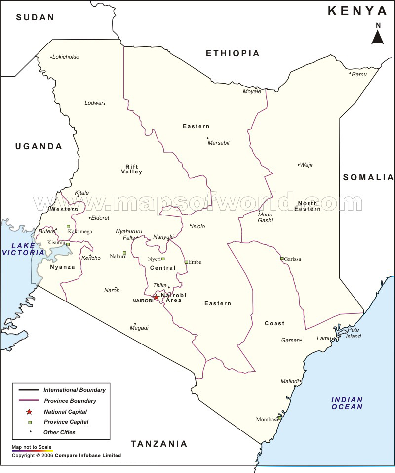
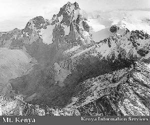
Kenya lies across the equator in east-central Africa, on the coast of the Indian Ocean. It is twice the size of Nevada. Kenya borders Somalia to the east, Ethiopia to the north, Tanzania to the south, Uganda to the west, and Sudan to the northwest. In the north, the land is dry. In the southwest corner is in the fertile Lake Victoria Basin. A length of the eastern depression of the Great Rift Valley separates western highlands from those that rise from the lowland coastal land. The land of Kenya covers 219,788 square miles. That means that it is twice the size of the state of Nevada or slightly smaller than Texas. Much of northeastern Kenya is a flat, bush-covered plain. The remainder of the country includes beautiful beaches, scenic highlands and lake regions, and the amazing Mount Kenya. Mount Kenya is 17,058 feet tall. Mt. Kenya is a dome-shaped central volcano. It is the largest mountain in Kenya. Originally, Mt. Kenya was over 20,000 ft high but has been heavily eroded. Most of this erosion occurred during two periods when glaciers carved much of the top of the volcano. In fact, almost 35% of the volcano has been worn away. Several types of volcanic rocks make up the mountain. The most common rocks are basalts. The Mount Kenya Suite consists of all the rocks erupted from Mt. Kenya and volcanoes that were built by it. It covers 2700 square miles in a 65 mile diameter circle around the volcano.
Kenya lies across the equator in east-central Africa, on the coast of the Indian Ocean. It is twice the size of Nevada. Kenya borders Somalia to the east, Ethiopia to the north, Tanzania to the south, Uganda to the west, and Sudan to the northwest. In the north, the land is dry. In the southwest corner is in the fertile Lake Victoria Basin. A length of the eastern depression of the Great Rift Valley separates western highlands from those that rise from the lowland coastal land.
The land of Kenya covers 219,788 square miles. That means that it is twice the size of the state of Nevada or slightly smaller than Texas. Much of northeastern Kenya is a flat, bush-covered plain. The remainder of the country includes beautiful beaches, scenic highlands and lake regions, and the amazing Mount Kenya.
Mount Kenya is 17,058 feet tall. Mt. Kenya is a dome-shaped central volcano. It is the largest mountain in Kenya. Originally, Mt. Kenya was over 20,000 ft high but has been heavily eroded. Most of this erosion occurred during two periods when glaciers carved much of the top of the volcano. In fact, almost 35% of the volcano has been worn away.
Several types of volcanic rocks make up the mountain. The most common rocks are basalts. The Mount Kenya Suite consists of all the rocks erupted from Mt. Kenya and volcanoes that were built by it. It covers 2700 square miles in a 65 mile diameter circle around the volcano.
Thanks for viewing my page!